1
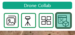
เปิด Drone Toolbox
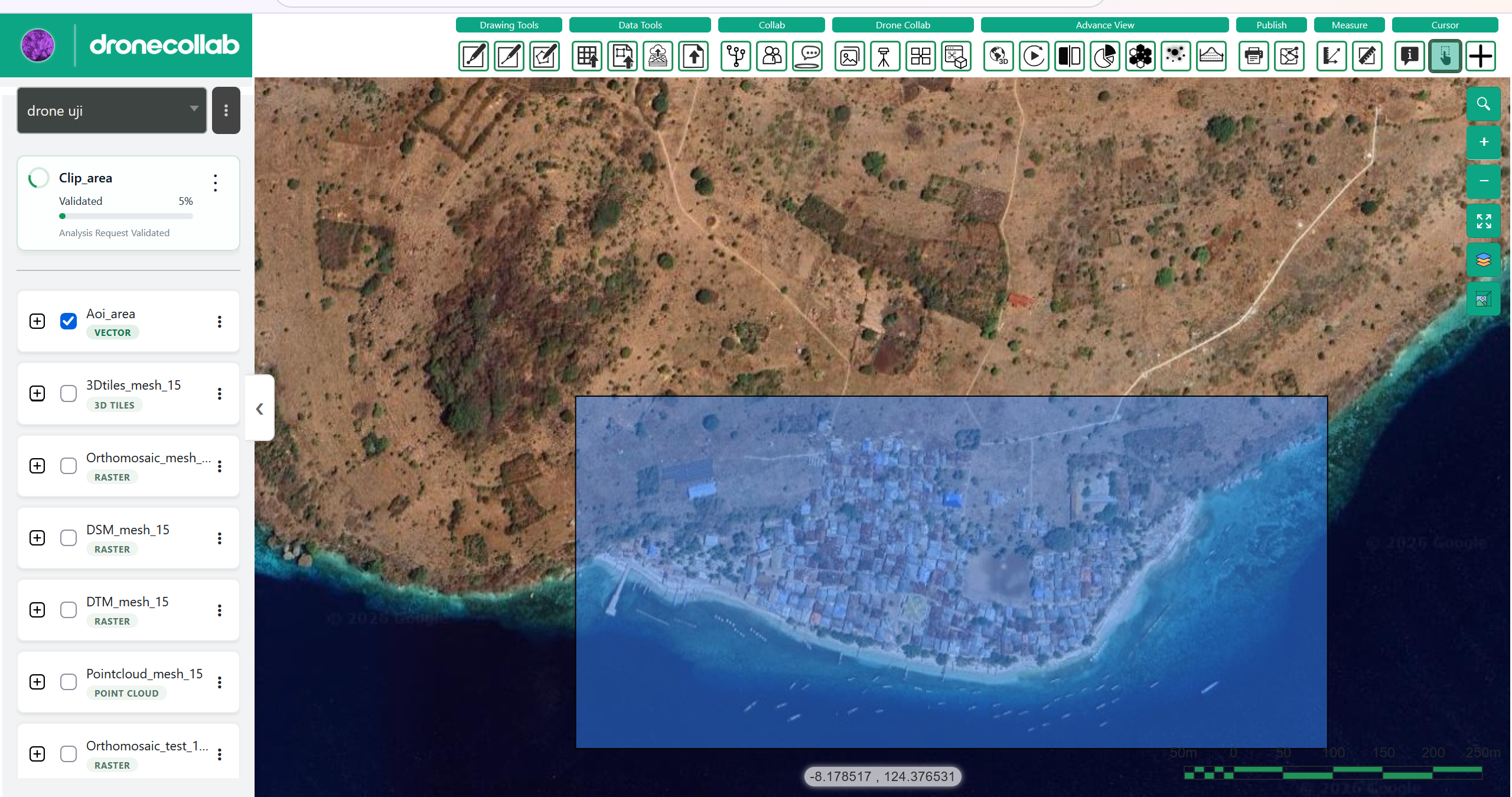
ในกลุ่ม Drone Collab ให้คลิกไอคอน toolbox ตามภาพ
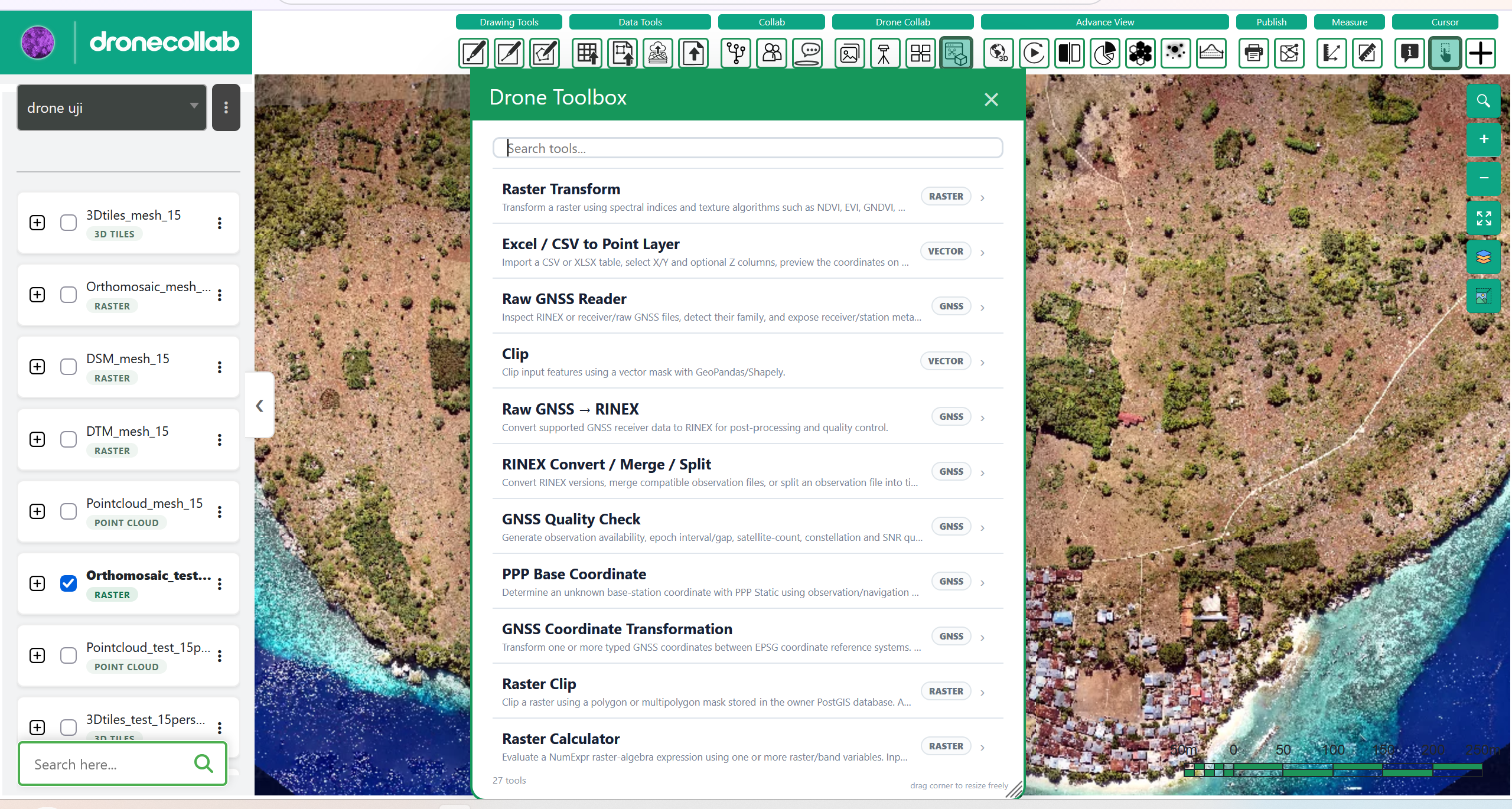
ค้นหา Raster Clip ใน Drone Toolbox เตรียมเลเยอร์ raster และหน้ากากรูปหลายเหลี่ยมจากโครงการ
2
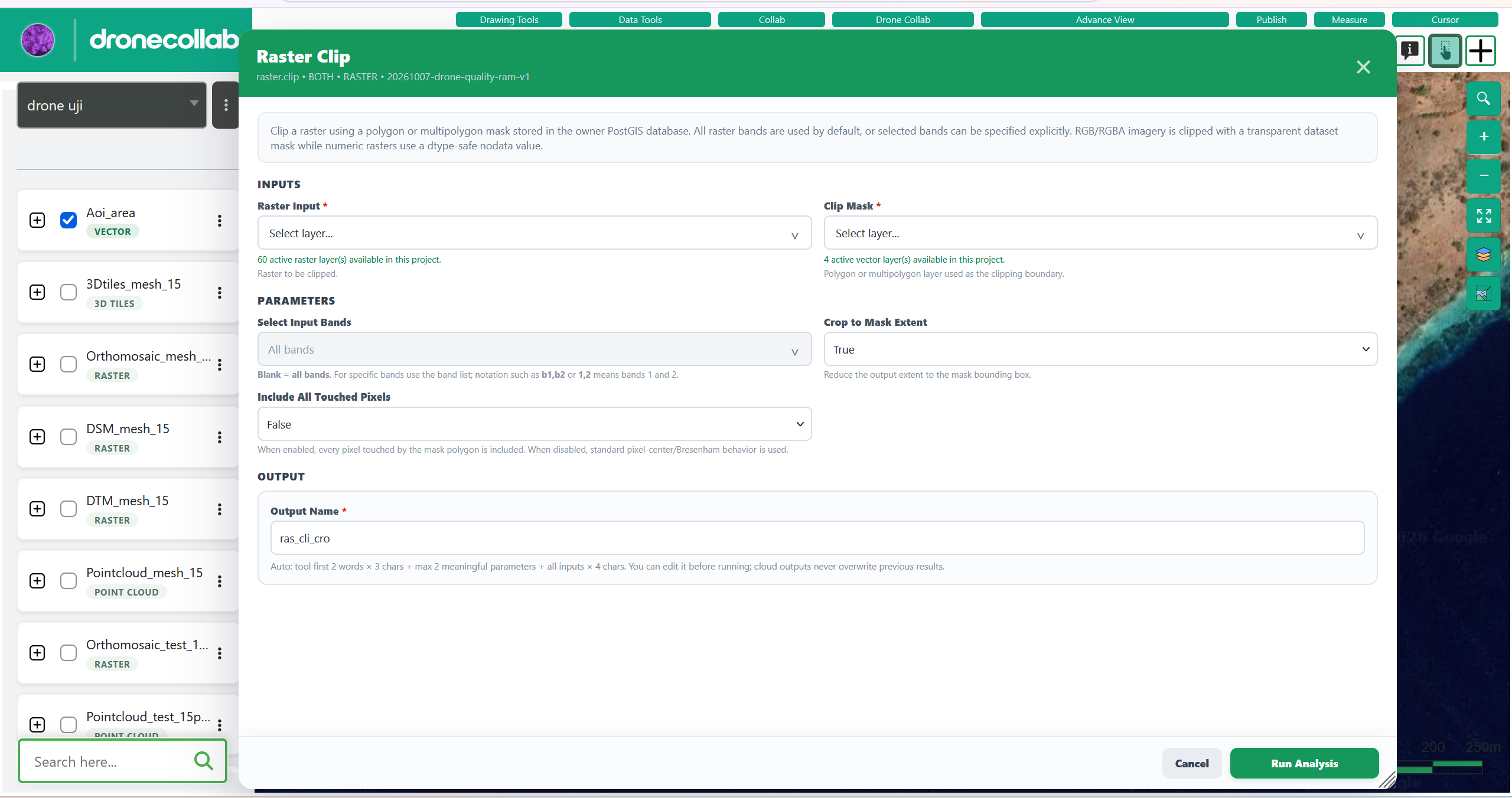
ตั้งค่า Raster Clip
เลือก Raster Input และ Clip Mask โดยหน้ากากต้องเป็นเลเยอร์ polygon หรือ multipolygon
ตรวจสอบ Select Input Bands, Crop to Mask Extent และ Include All Touched Pixels แล้วกรอก Output Name ที่ชัดเจน
3
ประมวลผลและตรวจสอบผล
คลิก Run Analysis แล้วรอให้เลเยอร์ผลลัพธ์ประมวลผลเสร็จ
เปิดผลลัพธ์ใน Layers และตรวจสอบขอบเขตกับหน้ากาก หากล้มเหลวให้อ่านสถานะงาน
4
สำรวจเครื่องมืออื่น
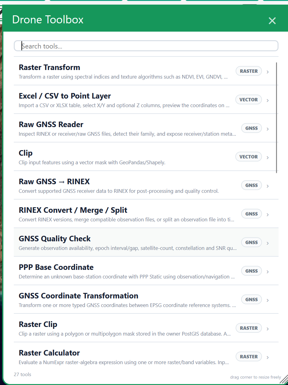
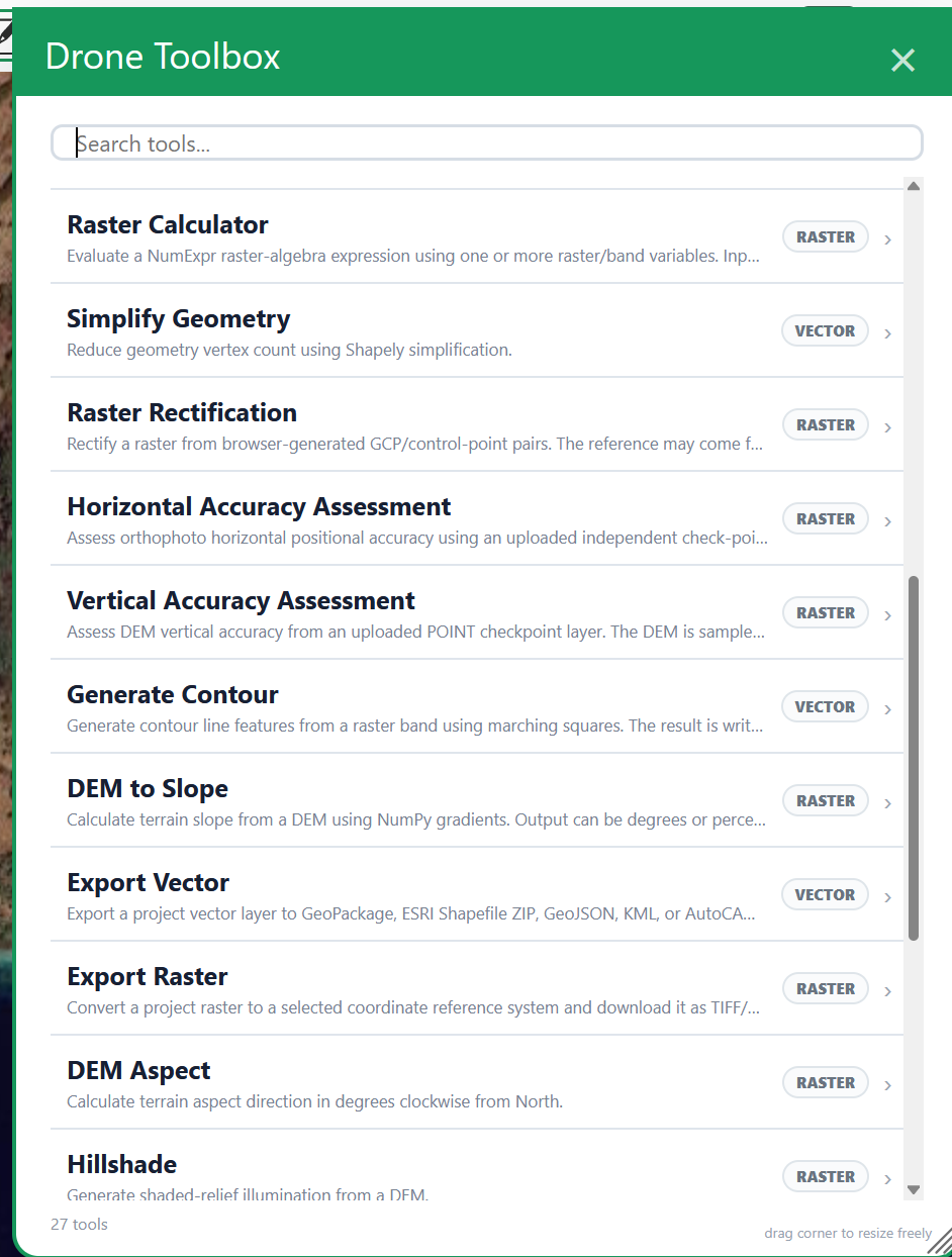
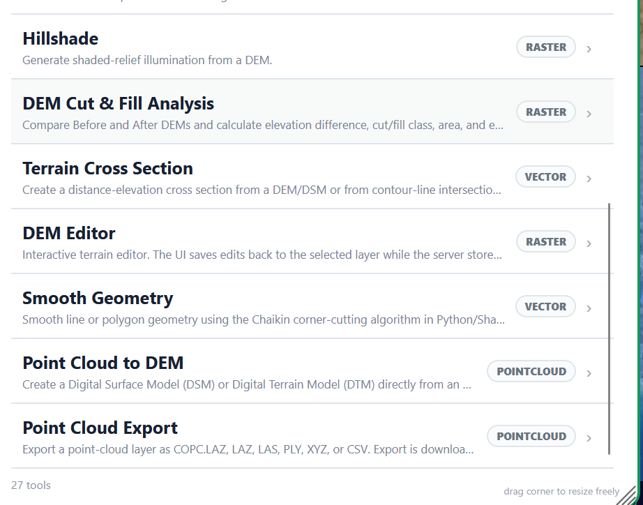
ภาพรายการสามภาพแสดง 27 เครื่องมือสำหรับ raster, vector, GNSS และ point cloud
เลือกเครื่องมือให้ตรงกับงานและตรวจสอบข้อมูลที่ต้องใช้ ใน toolbox ยังมี Export Vector, Export Raster และ Point Cloud Export
RASTER
- Raster Transform
- Raster Clip
- Raster Calculator
- Raster Rectification
- Horizontal Accuracy Assessment
- Vertical Accuracy Assessment
- DEM to Slope
- DEM Aspect
- Hillshade
- DEM Cut & Fill Analysis
- DEM Editor
- Export Raster
VECTOR
- Excel / CSV to Point Layer
- Clip
- Simplify Geometry
- Generate Contour
- Export Vector
- Terrain Cross Section
- Smooth Geometry
GNSS
- Raw GNSS Reader
- Raw GNSS → RINEX
- RINEX Convert / Merge / Split
- GNSS Quality Check
- PPP Base Coordinate
- GNSS Coordinate Transformation
POINTCLOUD
- Point Cloud to DEM
- Point Cloud Export