Open workspace ↗
DRONECOLLAB · TECHNOGIS

Use post processing tools

Use Drone Toolbox to work with your results. This example clips a raster with a polygon.

Continue your drone mapping workflow with raster analysis tools, starting with the Raster Clip example below.

Raster Clip settings for selecting a raster layer and clipping polygon
Post Processing Tools
1Open Drone Toolbox
2Set Raster Clip parameters
3Run and check the result
4Explore the other tools

Use post processing tools

Click screenshots to enlarge

1
Drone Collab / Drone Toolbox

Open Drone Toolbox

In the Drone Collab group, click the toolbox icon shown in the screenshot.

Find Raster Clip in Drone Toolbox. Prepare a raster layer and a polygon mask from your project.
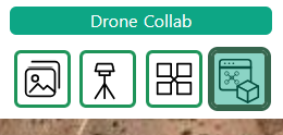
Drone Toolbox icon in the Drone Collab toolbar group
Drone Collab / Drone Toolbox
Drone Toolbox panel for choosing post processing and analysis tools
Drone Collab / Drone Toolbox
2
Drone Toolbox / Raster Clip

Set Raster Clip parameters

Select Raster Input and Clip Mask. The mask must be a polygon or multipolygon layer.

Review Select Input Bands, Crop to Mask Extent and Include All Touched Pixels. Enter a clear Output Name.
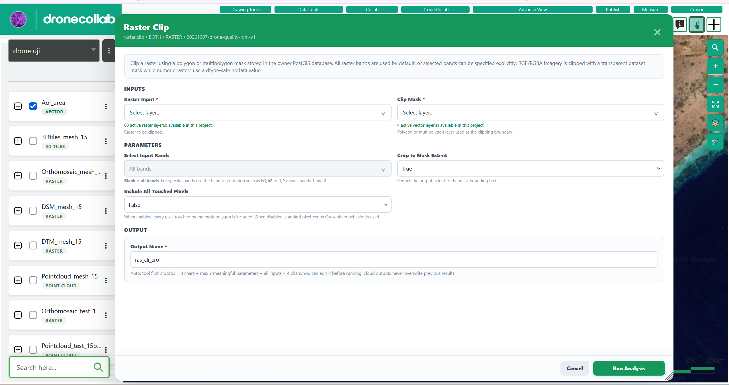
Raster Clip settings for selecting a raster layer and clipping polygon
Drone Toolbox / Raster Clip
3
Raster Clip / Run Analysis / Layers

Run and check the result

Click Run Analysis and wait for the output layer to finish processing.

Activate the result in Layers and check its boundary against the mask. Read the job status if processing fails.
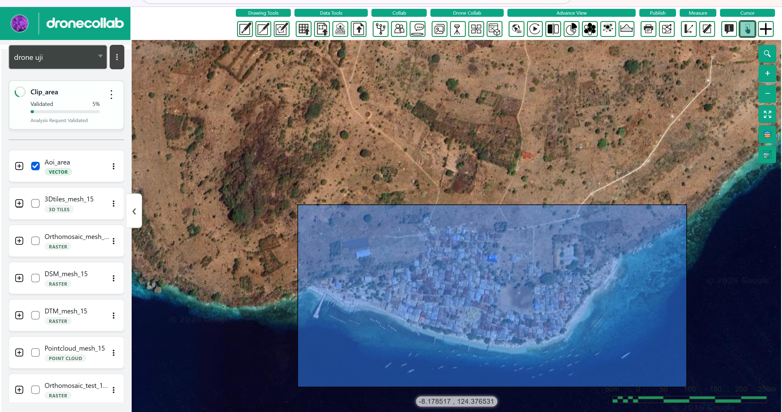
Clipped raster output displayed in DroneCollab map layers
Raster Clip / Run Analysis / Layers
4
Drone Toolbox / Tool catalogue

Explore the other tools

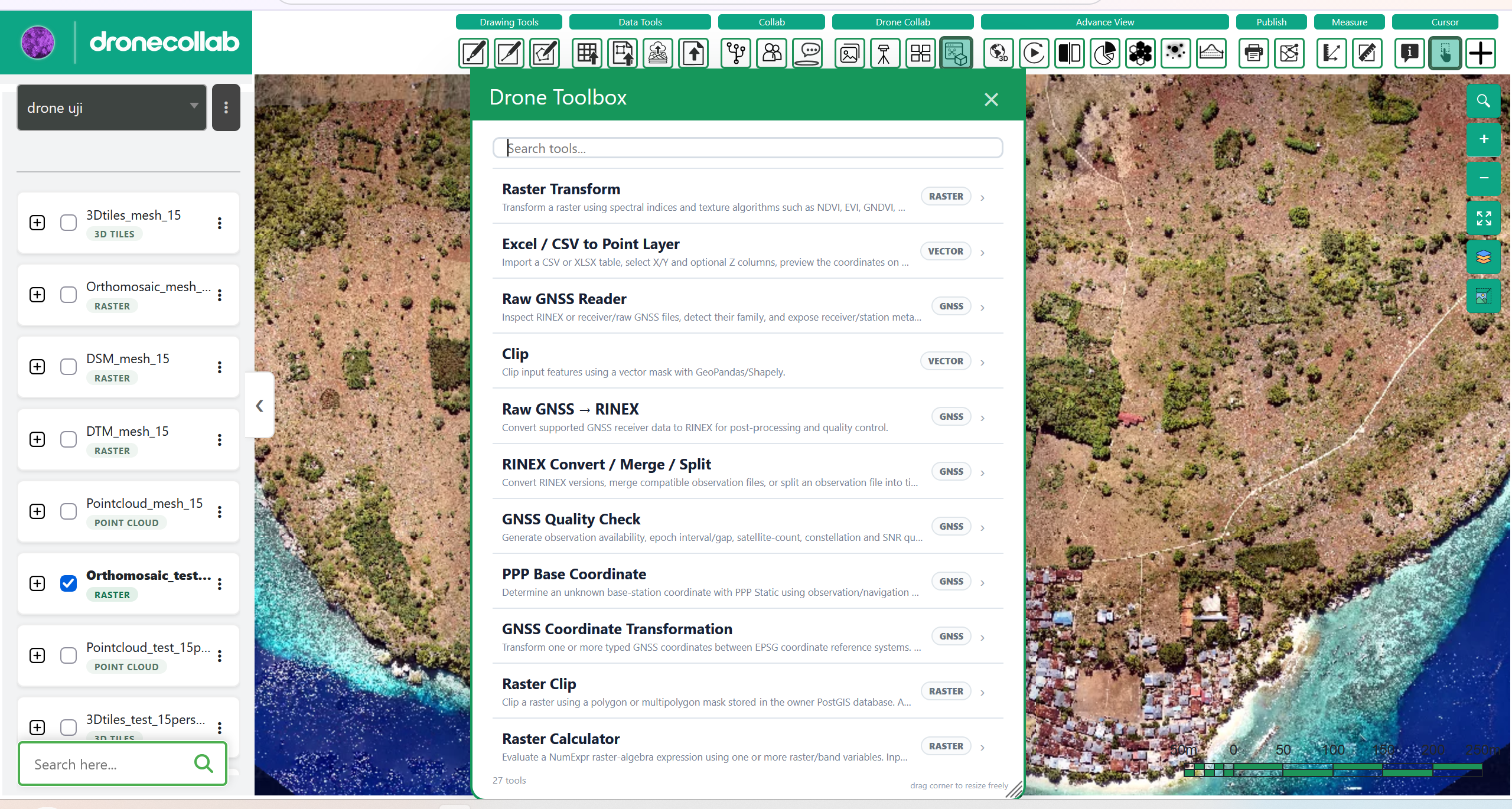
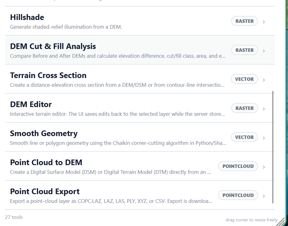
The three catalogue screenshots show 27 tools for raster, vector, GNSS and point-cloud work.

Choose a tool for your task and check its required inputs. Export Vector, Export Raster and Point Cloud Export are also in this toolbox.
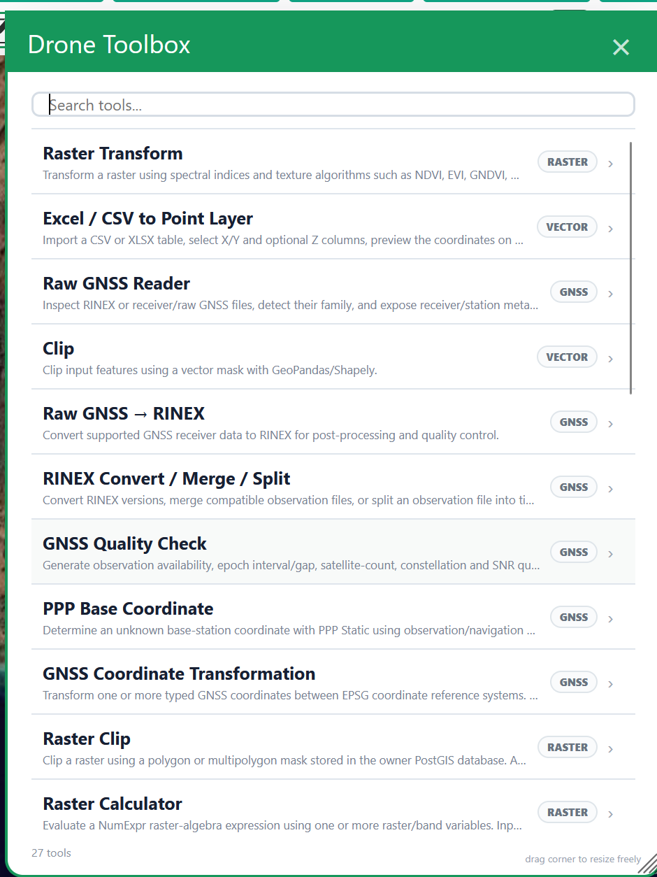
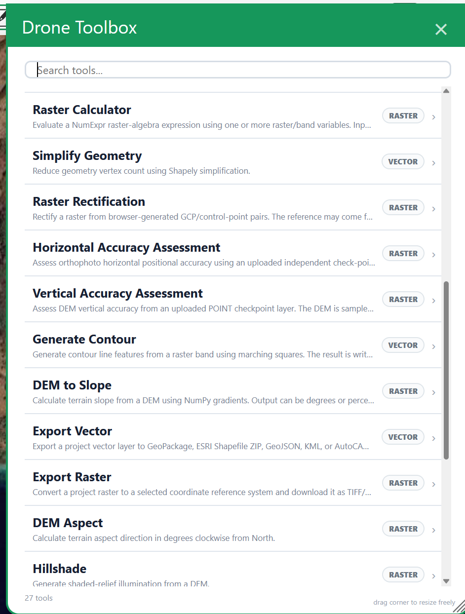
Drone Toolbox analysis tool catalogue, first panel
Drone Toolbox / Tool catalogue
Drone Toolbox analysis tool catalogue, second panel
Drone Toolbox / Tool catalogue
Drone Toolbox analysis tool catalogue, third panel
Drone Toolbox / Tool catalogue

RASTER

  • Raster Transform
  • Raster Clip
  • Raster Calculator
  • Raster Rectification
  • Horizontal Accuracy Assessment
  • Vertical Accuracy Assessment
  • DEM to Slope
  • DEM Aspect
  • Hillshade
  • DEM Cut & Fill Analysis
  • DEM Editor
  • Export Raster

VECTOR

  • Excel / CSV to Point Layer
  • Clip
  • Simplify Geometry
  • Generate Contour
  • Export Vector
  • Terrain Cross Section
  • Smooth Geometry

GNSS

  • Raw GNSS Reader
  • Raw GNSS → RINEX
  • RINEX Convert / Merge / Split
  • GNSS Quality Check
  • PPP Base Coordinate
  • GNSS Coordinate Transformation

POINTCLOUD

  • Point Cloud to DEM
  • Point Cloud Export

Use post processing tools

The example uses Raster Clip. Parameters and available tools should be checked in your own workspace.

Open workspace ↗