Open workspace ↗
DRONECOLLAB · TECHNOGIS

Draw points, lines and areas

Create vector layers on your drone map and complete their feature attributes.

Use your drone maps as the base for cloud map collaboration, then add points, lines, polygons, and attributes with this guide.

Drawing a polygon area on a DroneCollab orthomosaic map
Drawing Point, Line & Area
1Choose a drawing tool
2Draw and edit an area
3Draw a line
4Place points
5Complete feature attributes

Draw points, lines and areas

Click screenshots to enlarge

1
Drawing Tools / Point · Line · Polygon

Choose a drawing tool

In Drawing Tools, choose Point, Line or Polygon for the feature you need.

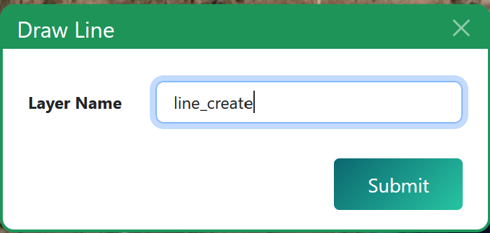
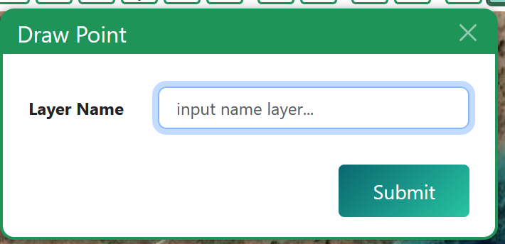
Enter Layer Name and click Submit. Use a different name for each vector layer.
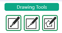
Drawing Tools toolbar with point, line, and polygon icons
Drawing Tools / Point · Line · Polygon
Vector line layer setup in the DroneCollab drawing workflow
Drawing Tools / Point · Line · Polygon
Vector point layer setup in the DroneCollab drawing workflow
Drawing Tools / Point · Line · Polygon
2
Drawing Tools / Polygon

Draw and edit an area

Use Polygon to trace the boundary of an area on the map.

Use the polygon editing controls to adjust the shape, then save with the disk icon.
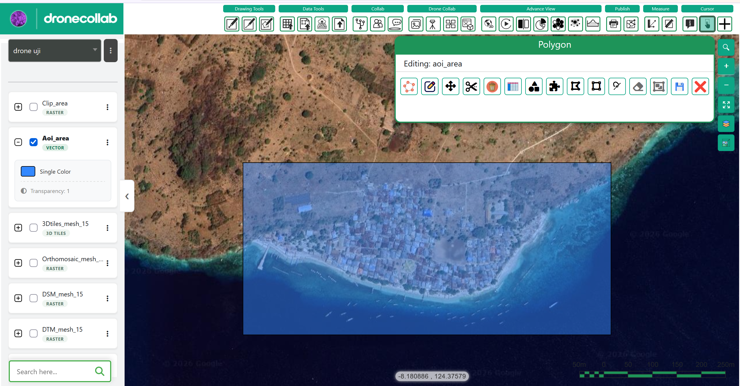
Drawing a polygon area on a DroneCollab orthomosaic map
Drawing Tools / Polygon
3
Drawing Tools / Line

Draw a line

Open the Line drawing panel and click the map to trace your line.

Follow the map prompt to finish. Check the geometry and save the layer with the disk icon.
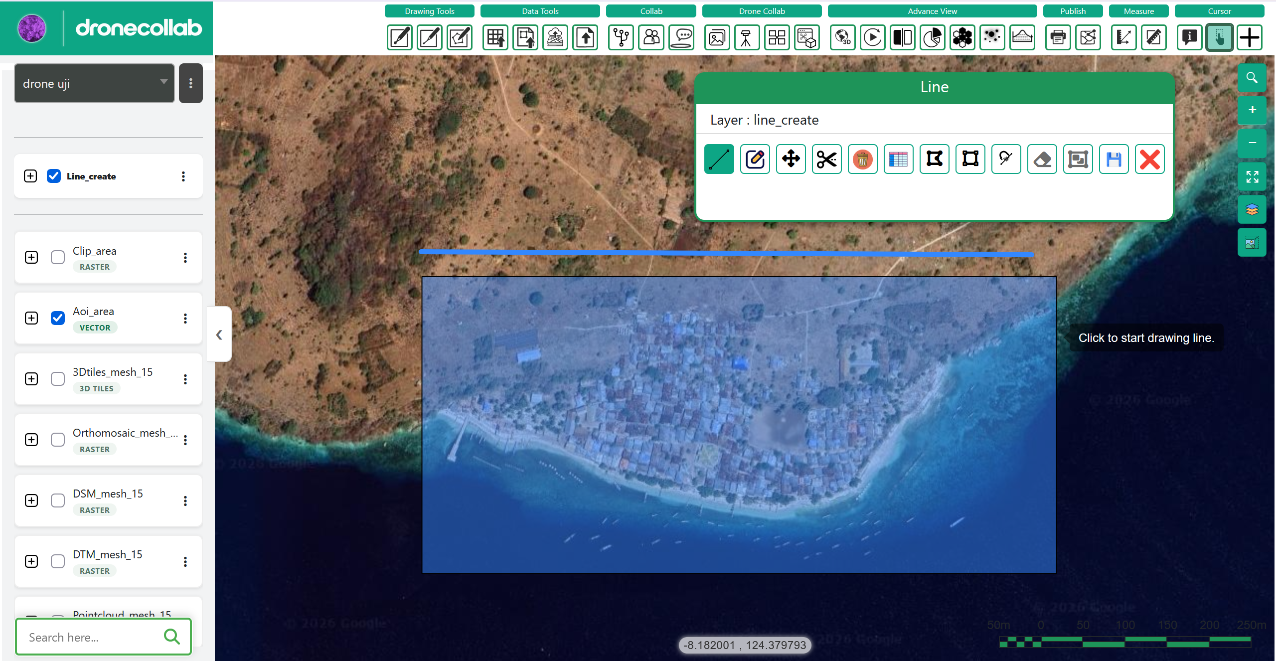
Drawing a line feature on a DroneCollab drone map
Drawing Tools / Line
4
Drawing Tools / Point

Place points

Open the Point drawing panel and click the map to place a point.

Add the points you need, check their positions and save with the disk icon.
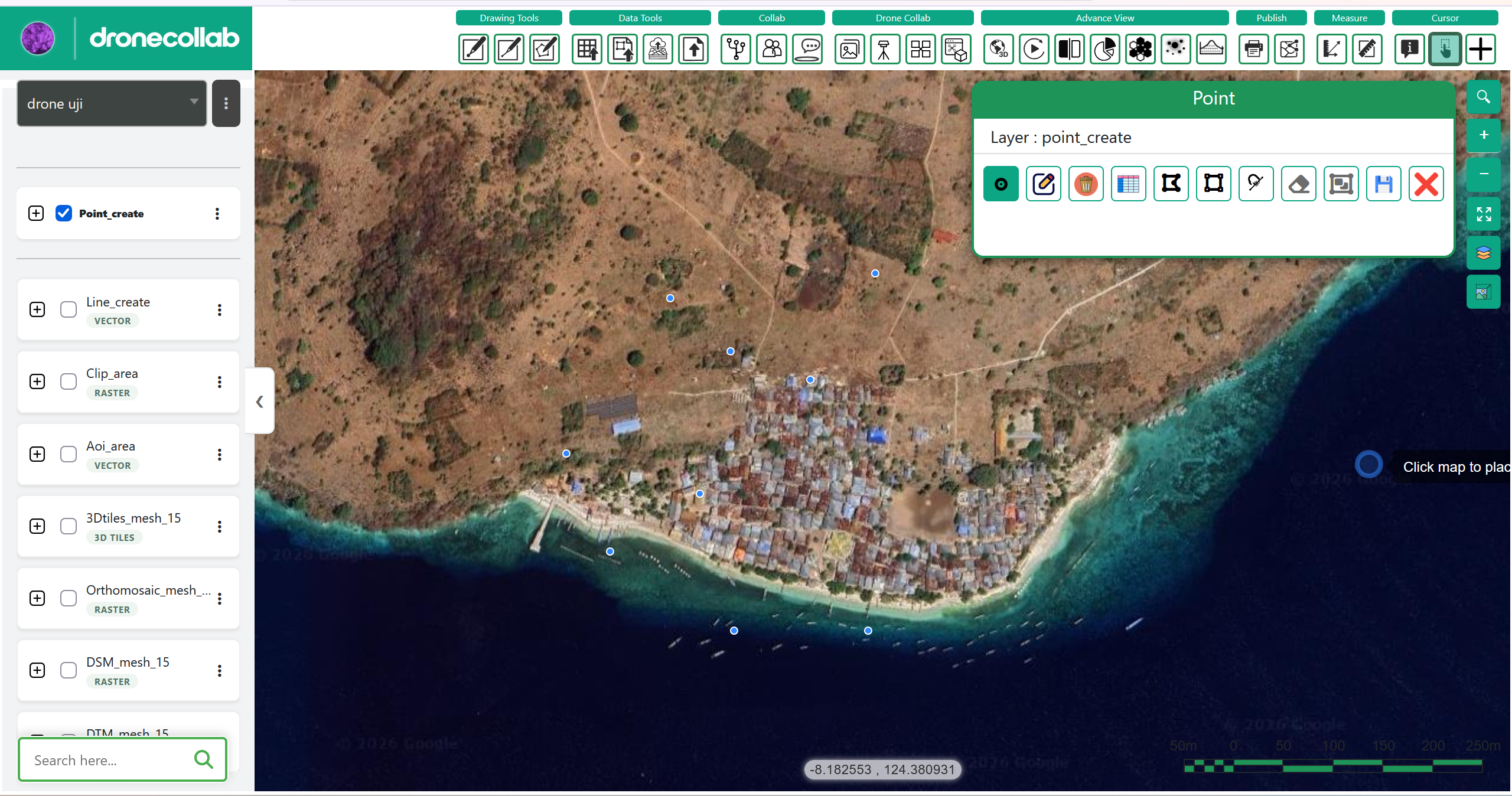
Adding a point feature to a DroneCollab drone map
Drawing Tools / Point
5
Feature Attributes / Add Field / Done

Complete feature attributes

Open Feature Attributes for the feature. Fill in the available Field and Value entries.

If no editable fields exist, choose Add Field. Use Done when finished; attributes can also be completed later.
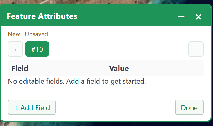
Feature Attributes panel for adding fields to a vector map layer
Feature Attributes / Add Field / Done

Draw points, lines and areas

Use distinct layer names and check both geometry and attributes before continuing.

Open workspace ↗