Agriculture
Rice Trial Phenotyping with Plot Boundaries That Preserve the Experiment
Agricultural trial imagery becomes useful when every measurement remains connected to the experimental design.
5 min readRead article
THE DRONE COLLAB JOURNAL
Explore practical photogrammetry, GNSS, IMU, GIS and remote sensing methods. Technical explanations, worked examples and field checks for the people turning aerial photographs into usable maps.
Agricultural trial imagery becomes useful when every measurement remains connected to the experimental design.
Rice color and canopy structure can help organize a harvest inspection campaign, particularly when planting dates vary across an estate.
Lodged rice changes canopy texture, orientation and visible surface shape.
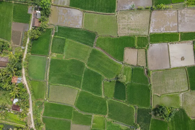
A rice paddy image captures a moment in an irrigation cycle.
Neighboring rice paddies can have different canopy cover simply because they were transplanted on different days.
Early rice establishment is a spatial continuity problem.
A round trip test exports data to another format and reads it back for comparison.
A data manifest records what a release contains and how its parts should be interpreted.
Raster storage and processing demand depend on dimensions, band count, numeric type, masks, overviews, compression, and temporary operations.
Zonal statistics summarize raster values within vector regions, but the result depends on cell inclusion, partial coverage, missing data, and the meaning of the raster.
Digitizing converts image interpretation into explicit geometry.
A profile samples elevation along a defined line, while a cross section often compares point geometry within a corridor around that line.
No matching articles. Try a broader technical term.